
BibleMap makes me realise how much of a map nerd I am. I get such a thrill out of using this site. The concept is quite simple-you look up a section of text you are looking at (the sections are per chapter and the two searchable options are ESV and KJV though we won't hold that against them for long). The site then uses Google maps to show where each location mentioned in the text is. What's particularly great about this is that you can utilise the Google satellite function to see the actual terrain of the land, and how settlements and towns have grown up around the historical locations. All we need now is for the power of Google to harness time and show us in detail how the location would have looked in biblical times! The site also has a developing page which shows "events", meaning you can track the journeys of biblical characters. At the moment this only features Paul. Fingers crossed from some Exodus related info soon!
If you can't find it here you won't be able to find it anywhere! This is a great website as a a "one stop shop" for biblical maps.
Visual Bible has to be praised for making all their resources free for non-commercial use, all you have to do it sign up for membership-quick, easy and spam free. Lots of pictures and maps all of high quality are available for download-excellent, well organized source. Thanks to Brendan for finding this one!
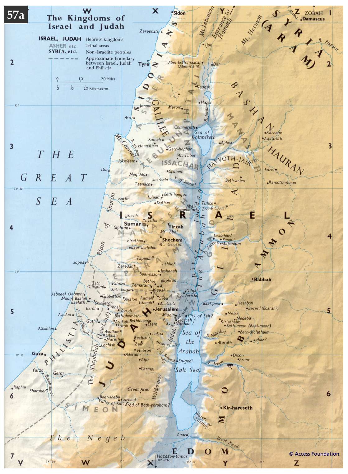
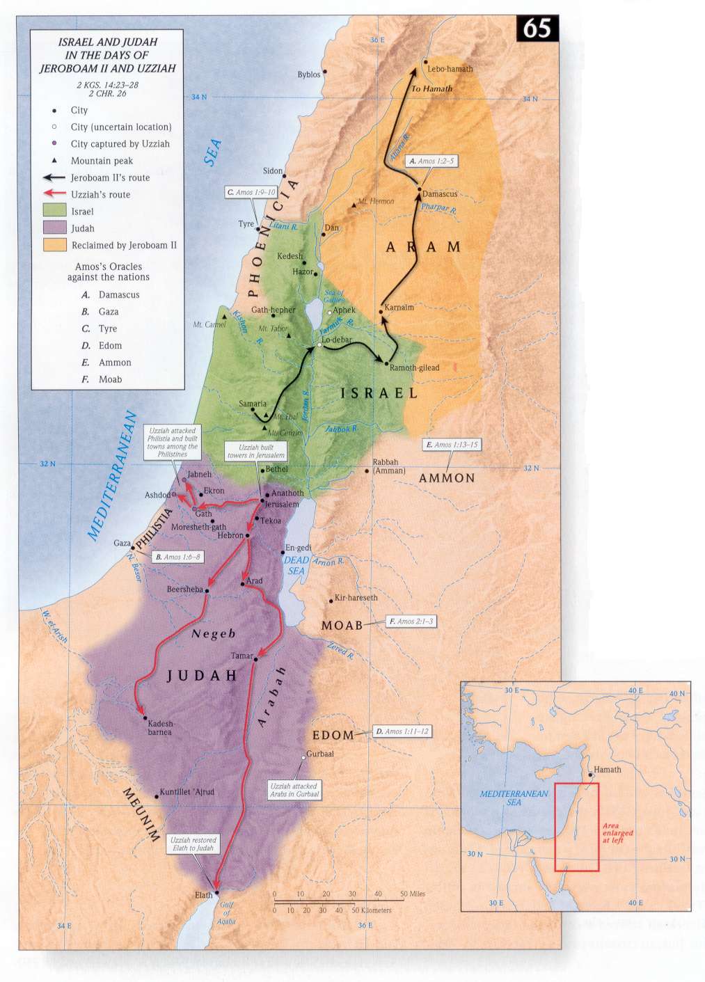
 My favourite website has a huge amount of biblical maps (132 at last count) which are all downloadable in jpeg format and print and photocopy incredibly well. They work on PowerPoints and are very clear and colourful. Some I use in class are the Kingdoms of Israel and Judah(1) and (2), and Israel & Judah in the days of Jeroboam II and Uzziah
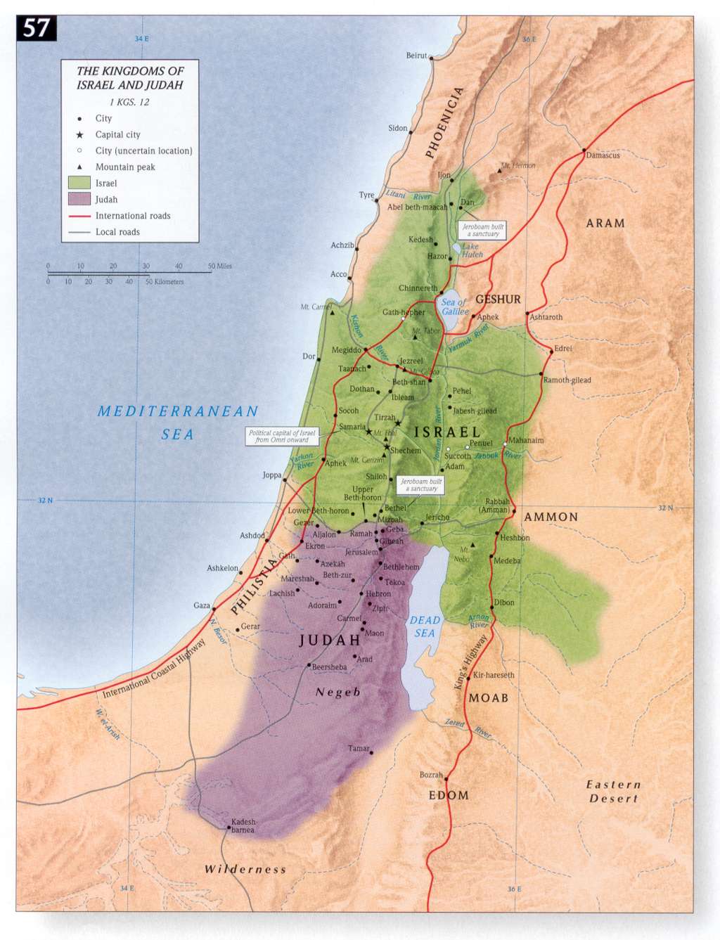

This works really well with the class debate on the "actual" route of the Exodus
 Book of Numbers
 So where is Mount Sinai then?

For more modern maps have a look at the tourist website for downloadable (and very cute) Pdf files.
For buying maps and an atlas (or ten) look at BibleBooks and Maps which publishes in association with Carta Jerusalem.
And you'll need one of these, otherwise you'll be leaping up and down in front of your data projector!
This is a really helpful tool for understanding where events in scripture took place.
ReplyDelete